|
|
 |
|
Below:
Loading our gear and posing for a quick picture at the
trailhead. It could not have been a nicer day! |
|
|

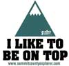
Check out Summit County Explorer's
"I LIKE TO BE ON TOP"
T-shirt and gear!
Click logo above
|
|
For the first mile or so the path
descends through the notorious willows
that plagued hikers in the past. A clear trail, complete with
boardwalks, now make this a pleasant walk. Keep an eye out for
wildlife as several hikers recently reported seeing mountain
lion enjoying their vantage point from rocky ledges in the early
morning sun. However, on our
recent trek to the summit we encountered only mule deer, rabbits
and
ptarmigian.
As you begin your climb through a long
series of switchbacks that lead to the ridge just below the
summit, enjoy the views of Grey and Torreys off to the west. |

|
 |
You can also spot Long's Peak to the
north. The last
quarter of a mile or so requires a final pull and rock scramble to the
summit.
Cairns are not always easy to spot here
so pick your way carefully. |
 |
|
|
|
|
|
Above:
Looking back to where we came from. In the dark green band of
foliage is the parking lot... Check out the blue sky! We had a
perfectly clear day. |
Above:
The last pull to the peak... A SCE explorer rests on the edge of
a boulder (center) |
|
|
|
|
 |
One disadvantage is that on the way down
you can easily see the parking lot off in the distance. It often seems
like you are not getting any closer!
However, while it is true there is no such thing as an "easy"
fourteener, Bierstadt enjoys a well deserved reputation as one of the
easiest! |
 |
|
|
|
|
|
The
last steps to the peak (inset) and the arms raised in VICTORY!
Looking out towards Quandry. It was about 80 degrees and a
refreshing breeze at the peak! |
Two
SCE explorers sporting the "I like to Be On Top T-Shirts
enjoying lunch. We had the opportunity to hang out on the peak
for over an hour before we decided to head back down! |
|
|
|
|
|
|
|
|
|
|

|
beginner
|
|
intermediate
|
|
advanced
|
|
|
|
Black
Powder Pass
|
|
Mohawk
Lake
|
|
Quandary
Peak
14,265' |
|
|
|
Lily
Pad
|
|
Chihuahua
Gulch
|
|
Lincoln & Bross
14,291' / 14,177' |
|
|
|
St.
John's
|
|
Mt.
Royal
|
|
Bierstadt Peak
14,060' |
|
|
|
Mayflower Gulch |
|
Wheeler Lakes |
|
Willow & Salmon Lakes |
|
|
|
Loveland Pass |
|
Radical Hill Trail |
|
Upper Crystal Lake |
|
|
|
Salt Lick
Trail |
|
McCullough Gulch |
|
Gray's & Torrey's
14,278' / 14,267' |
|
|
|
Mesa
Cortina Trail |
|
Mt.
Sniktau |
|
Mt. Democrat
14,152' |
|
|
|
St. Mary's Glacier |
|
North
Ten Mile Trail |
|
Mt.
Victoria |
|
|
|
Sally Barber Mine |
|
Willow
Falls |
|
Mt.
Elbert
14,433' |
|
|
|
Oro
Grande Trail |
|
Eaglesmere Lakes |
|
Buffalo Mountain
12,777' |
|
|
|
Meadow Creek-Salt Lick |
|
Mosquito Pass |
|
Eccles Pass |
|
|
|
Shrine Mountain
Trail |
|
Webster Pass |
|
Mt. Huron 14,003' |
|
|
|
Ptarmigan Trail |
|
Ptarmigan via Wilder Gulch |
|
|
|
|
|
Peaks Tr. Barton Gulch |
|
Wheeler
Lake - Park County |
|
|
|
|
|
Hoosier Pass Loop |
|
Lenawee
Trail |
|
|
|
|
|
Spruce Creek Loop |
NEW! |
Nightmare on Baldy Mine |
|
|
|
|
NEW! |
Tenderfoot
Mountain Trail |
|
|
|
|
|
|
|
Did You find our FREE trail descriptions useful?
Please donate a buck or
two.
We appreciate your support! |
 |
|
|
|
|
|
|
|
|
|
|
|
|
|


