|
Description:
For the first 2.6 miles you follow the Mesa Cortina Trail
to its junction with the Gore Range Trail (for a description of
the Mesa Cortina Trail see our listing of that trail in the
"easy" category of our hikes.)
As you approach the junction of the Mesa Cortina and Gore Range
Trails you will cross South Willow Creek.
At the trail junction you should
proceed west-southwest (straight) on the Gore Range Trail. After
about a mile you will notice the Buffalo Cabin Trail entering on
your left. The falls are about three quarters of a mile ahead.
|
 |
 |
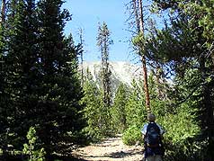
You will enter the deep gorge
between Buffalo Mountain and Red Peak. Here the trail begins an
ascent to the falls and becomes increasingly rocky.
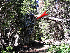
About 10-15 minutes before arriving at your destination you will
pass a huge boulder (15' on your left (see photo - left). Soon
the sound of rushing water and a path on your
|
 |
|
Above: This is the huge 15 foot bolder (marked with red
indicator) that you pass. |
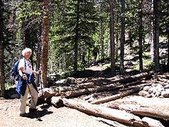
Above: Cabin ruins just a few hundred yards from the lower
falls. |
 |
left leads you to cabin ruins and
the lower falls.
The National Geographic Topo Map of
"Vail,Frisco & Dillon" is an invaluable resource for this hike.
Purchase a copy from Weber's bookstore in Breckenridge by
clicking on the link on our home page.
|
 |
|
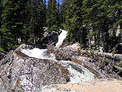
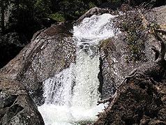
Above: Photo of another section of Willow Falls
|
|
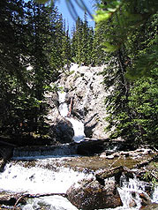
Above: Photo of a section of Willow Falls |
|
|
 |

Check out Summit County Explorer's
"I LIKE TO BE ON TOPTM"
T-shirt and gear!
Click logo above |
|
Right: Photo of another section of Willow Falls |
|


